|
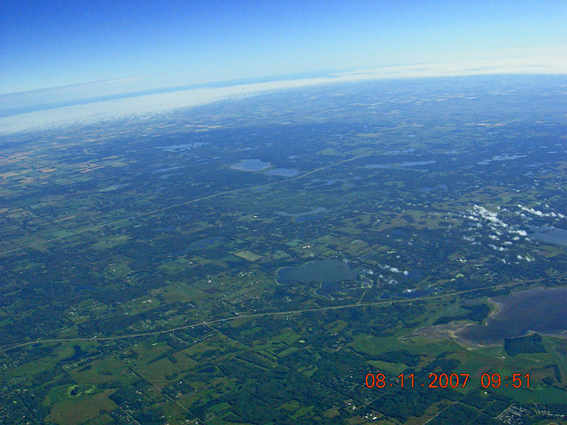
Wye Road is seen running across the lower half of the image with Antler Lake in the center just above, and North Cooking Lake on right just below, Wye Road. Highway 16 runs across the center of the image and past the heavily treed Elk Island National Park and its Little Tawayik Lake and Tawayik Lake. Astontin Lake is further north in the distance and Oster Lake is about half the distance in the trees to the west. |
| Back to SABLE-3 Main Page Payload Photo's |
Next Image |