|
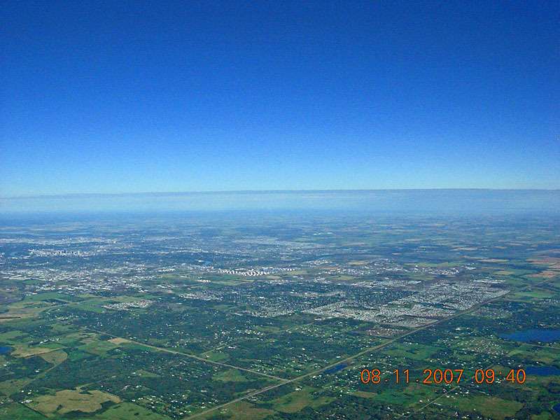
Highway 21 runs upwards, to the right, from the bottom and, after passing above the timestamp, runs along the east side of Sherwood Park. Township Road 522 runs diagonally to the left from Highway 21 to the Whitemud Freeway overpass on Highway 14 and the larger white structures near the center are the PetroCan oil storage tanks just North of Baseline Road and West of Highway 14. North-East, Downtown and North-West Edmonton can be seen along the left side as can the North Saskatchewan River as it wanders through the city and all the way across the center of the image to the right side. |
| Back to SABLE-3 Main Page Payload Photo's |
Next Image |